Civil 3D Optimization & Training for Land Surveyors
Cut Hours,
Not Corners.
Optimize Your Survey Workflow.
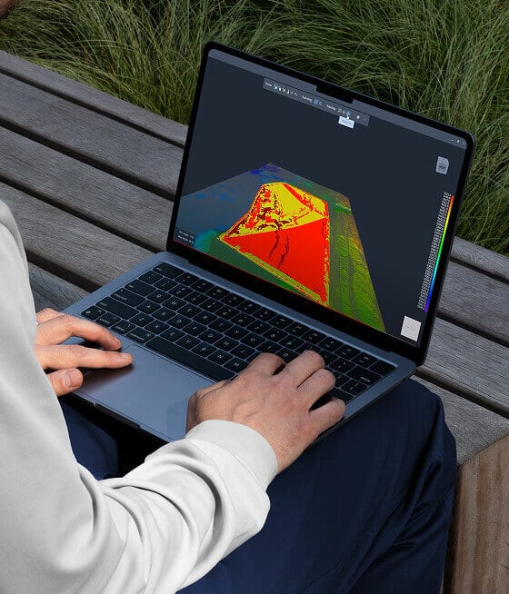
Stop losing time to extra steps in your workflow, inconsistent labels, and inefficient drafting. Our survey-driven Civil 3D training helps your team work faster, cleaner, and with total accuracy.
Your Workflow is Already Good. We Help Make it Faster.
Civil Solutions improves the systems you already rely on — your Survey Databases, labeling methods, drafting habits, and daily Civil 3D routines. We streamline the bottlenecks, automate the repetitive steps, and bring structure to the parts of your workflow that slow you down.
Our training and consulting turn your existing process into a faster, cleaner, and more consistent production pipeline — without changing how you survey or how you think. Just the same work, done in a fraction of the time.
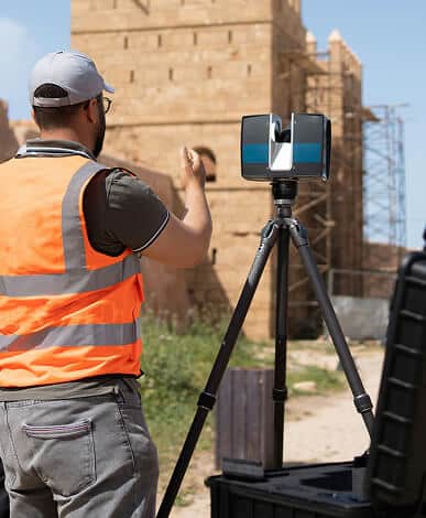
You’ve mastered the field. But when the data hits the office, are you getting the speed, consistency, and clarity you know you should?
Most land surveying teams are stuck in outdated, inconsistent Civil 3D workflows — slowing down production, causing frustration, and eating into profits. You don’t need more overtime. You need smarter systems.
Created by a surveyor who knows exactly what it takes to streamline production and increase profits.
“I’ve lived through the same bottlenecks you’re facing, and I know how costly outdated workflows can be. With Civil Solutions, my goal is simple: give you practical systems, real training, and the confidence to modernize your operation without months of trial and error.”
Mark Prewitt, Founder,
Professional Land Surveyor, Owner of HMC Land Surveying
Database Setup & Automation
Workflows Designed for How You Work
You don’t need to start from scratch. You just need to optimize what’s already there — and align your team around it. We help you do just that, through:
You’ll create dynamic survey databases that eliminate manual steps. Build once — reuse forever. Get seamless integration from field to finish using your own codes, figures, and standards.
02 /
Labeling That Works for You
Ditch the confusion. We help you develop and implement intuitive, customizable label styles for lines, curves, parcels, and more — giving every user instant access to the right label at the right time. No more depending on CAD specialists or fighting global changes.
03 /
Custom Workspaces & Productivity Macros
Cut the clutter. Streamline your environment with personalized workspaces and task-specific macros that simplify repetitive commands and workflows. This alone can save 30+ minutes per day, per user — that’s over 130 hours per year, per drafter.
workshops & virtual sessions
Training That Meets You Where You Are
Whether you prefer hands-on guidance or digital flexibility, we offer:
In-Person Workshops Tailored to Your Workflows
Hands-on, on-site training built around your exact Civil 3D standards and daily production needs.
One-on-One Virtual Sessions to Fine-Tune Your Process
Focused, personalized guidance that helps you solve bottlenecks and optimize your workflow in real time.
Small Group Training to Align Entire Teams Remotely
Collaborative online sessions designed to unify standards, improve consistency, and keep everyone working the same way.
Knowledge Library for Land Surveyors
Our on-demand video library is always available to reinforce techniques, onboard new staff, and sharpen your efficiency.
From survey firms to engineering departments, we help organizations eliminate bottlenecks, standardize Civil 3D workflows, and unlock real efficiency across their entire operation.
Land Surveying Firms
Teams that want standardized workflows, faster production, and less rework.
Civil Engineering Departments
Offices that need clean survey data and consistent drafting outputs.
AEC Teams with Mixed Skill Levels
Growing teams that need clear, repeatable systems to avoid errors.
Companies Scaling Beyond “One Expert”
Firms relying on one power-user and needing broader team capability.
Owners Who Want Better Profit Margins
Leaders aiming to cut inefficiencies, reduce overtime, and modernize operations.
Contract Surveyors & Independent Professionals
Solo surveyors who want pro-level systems without months of trial and error.
Testimonials
What Teams Are Saying
Real feedback from survey and AEC teams who transformed their workflows with Civil Solutions.
“It didn’t take long to see a difference. Once we got past the initial setup, the day-to-day work got noticeably easier.”
“The biggest change for me was not having to second-guess how things were supposed to be set up. I spend less time going back and fixing drawings, which makes the work a lot less frustrating”
“The training didn’t change our standards. It changed how efficiently we apply them. Projects move through the office with fewer interruptions, and we’re getting more done with the same staff.”
Answers
Frequently Asked Questions
Do we need prior Civil 3D experience to benefit from the training?
No. The training is designed to meet you where you are. Whether you have years of Civil 3D experience or are relatively new to the software, the instruction focuses on practical workflows, efficiency, and real-world application — not theory or software menus. Experienced users typically gain speed and consistency, while newer users develop strong habits that prevent inefficiencies from ever forming.
Will the training work for our specific type of surveying projects?
Yes. Every surveying company operates differently, and that is intentional. The training is structured around your existing methods, standards, and project types, not a one-size-fits-all workflow. The goal is not to change how you survey — it’s to help you do what you already do, faster, cleaner, and with less rework, regardless of whether your work includes boundary, ALTA, construction staking, topographic surveys, or exhibits.
Can the video library replace the 4-day course?
The video library is designed to support and expand the 4-day course — not replace it. The in-depth training establishes the foundation, while the video library provides ongoing reinforcement, advanced topics, and solutions to real-world scenarios that arise after implementation. Many firms use the video library as a long-term resource to train new staff, revisit specific topics, and continue improving workflows well beyond the initial training.
What if our team has varying levels of experience with Civil 3D?
That is extremely common — and it’s exactly how the training is designed to work. The instruction focuses on standardized workflows, repeatable processes, and efficiency principles that benefit users at every experience level. More experienced users gain speed, consistency, and cleaner production, while newer users develop strong habits that prevent inefficiencies from forming.
Because the training is structured around your company’s workflows and project types, teams naturally align over time. The result is a more consistent production environment where everyone is working toward the same standards — regardless of where they started.